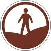
Access to the countryside and common land
In May 2005, the public gained the right to access to the countryside, on land designated by the Countryside Council for Wales as 'Access Land'. This includes 'open country' which is defined as 'mountain, moor, heath and down' and all registered Common Land.
This means that you can now access land on foot to carry out recreational activities like walking, running, bird watching and picnicking. No new rights of access have been given to horse-riders, cyclists or vehicle users.
See also: Motorised Access

This symbol shows that you are on or entering Access Land

This symbol shows that you are on or leaving Access Land
How much Access Land is there in Powys?
In addition to Common Land and designated 'open country', the Natural Resources Wales has dedicated most of the land within its control as Access Land. Due to its largely upland nature, Powys has a higher than average proportion of Access Land, 150,000 hectares. That's 29% of the land mass of Powys!
How can I find out where the Access Land is?
The best way to find Access Land is to look at an Ordnance Survey map. On these maps Access Land is shown by a yellow colour wash. Or contact the Natural Resources Wales
How is the Access Land managed?
Access Land in Powys is managed by Countryside Services. However, land in the Brecon Beacons National Park is managed by the Park Authority directly.
The Council is the Access Authority for Access land, and the Rights of Way Area Officers manage Access land along with the public rights of way within their work areas. This includes providing advice, undertaking maintenance, waymarking the Access land and in rare circumstances enforcement.
Follow us on:Contacts
Feedback about a page here


